AutoPlotter with LIS Software Price & Specifications
Usage Professional, Commercial, Infrastructure Projects
Type AutoPlotter with Land Information System (LIS) Software
Security Features User Authentication, Data Encryption, Access Control
Language Support English, Custom Language Packs Available
Interface Type USB, Serial, Ethernet
Compatible System Windows 7/8/10, 64-bit Operating Systems
Capacity (Person) Single User/Licensed Multiple Users
Application Surveying, Mapping, Land Record Management, and GIS Data Processing
Supply Ability 100 Per Month
Payment Terms Cash in Advance (CID)
Main Domestic Market All India
Delivery Time 7 Days
About AutoPlotter with LIS Software Detail
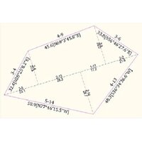
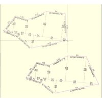
Highly recommended for professionals and organizations dealing with surveying, mapping, and land record management, AutoPlotter with LIS Software delivers unbeatable performance for large dataset processing. This peerless platform offers direct printing and plotting capabilities, supports multiple map output formats (PDF, DWG, DXF, GIS), and features inestimable integration with Total Station, GPS, and GNSS devices. For a limited time, take advantage of flexible licensing options, robust security, automatic data backup, and regular software updates. Order now and optimize your workflow with comprehensive support, interactive map views, and seamless data compatibility.
Extra Features and Broad Plant Application
AutoPlotter with LIS Software extends far beyond standard mapping tools with its automatic backup and recovery capabilities, interactive graphical display, multi-layer control, and peerless support for multiple coordinate systems. It's highly recommended for infrastructure projects, plant mapping, and land information management, due to its exceptional device integration. The machine's features, such as user authentication and flexible interface options, ensure unmatched reliability for complex professional tasks.
Export Markets, Delivery, and Reliable Packaging
AutoPlotter with LIS Software is widely supplied across various domestic markets and recognized globally as a peerless technology export. The product is carefully packaged and promptly handed over with full documentation and user manuals to safeguard its inestimable value. Orders for both single and multiple user licenses are dispatched efficiently, with delivery time depending on market zone and customization. List price includes comprehensive after-sales support for all distributed units.
FAQ's of AutoPlotter with LIS Software:
Q: How does AutoPlotter with LIS Software handle large datasets?
A: AutoPlotter with LIS Software is optimized for rapid processing of large datasets, ensuring high-speed performance even with extensive survey or mapping data. Its architecture and memory management are designed to handle bulk imports and exports efficiently.
Q: What licensing options are available for the software?
A: Customers can choose between a single license model for individual users or a floating license option suitable for multiple users. Both license types include peerless security and access control features.
Q: When are software updates provided and what do they include?
A: Regular software updates are provided to all licensed users, which include new features, compatibility enhancements, security improvements, and bug fixes, ensuring continuous optimal performance.
Q: Where can the software be used and what systems does it support?
A: AutoPlotter with LIS Software is compatible with Windows 7/8/10, 64-bit operating systems, and supports USB, serial, and Ethernet interfaces, making it suitable for professional and commercial environments across surveying, mapping, and land management sectors.
Q: What is the process for integrating field data from GPS or Total Station devices?
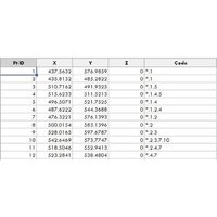
A: The software enables direct integration and seamless data import from Total Station, GPS, and GNSS devices using supported data input formats like ASCII, CSV, DXF, Shapefile, and LandXML, supporting efficient and accurate geospatial workflows.
Q: How does AutoPlotter ensure data security and backup?
A: The solution incorporates robust user authentication, data encryption, access control, and an automatic backup and recovery feature, safeguarding valuable data against loss and unauthorized access.

 GST No.07ABZFA3461F1Z6


 Our Products