APSL SOLUTIONS LLP

Delhi, India gst GST No.07ABZFA3461F1Z6

  • Surveyaan GeoWorkspace Software
  • product

Surveyaan GeoWorkspace Software

Minimum Order Quantity : 1 Units

Delivery Time : 7 Days

Surveyaan GeoWorkspace Software Price & Specifications

Usage Drone Survey

Product Type Surveyaan GeoWorkspace Software

Supply Ability 10 Per Week

Delivery Time 7 Days

About Surveyaan GeoWorkspace Software Detail


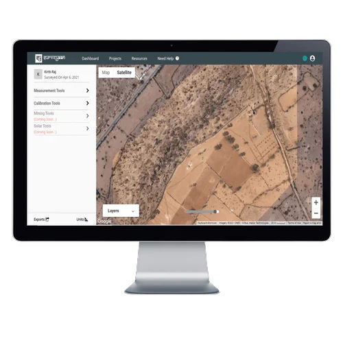
Discover a sizzling clearance value with Surveyaan GeoWorkspace Software-a commanding geospatial solution designed for pivotal land management tasks. This desktop-only powerhouse, optimized for Windows, brings you high-resolution maps, immersive satellite imagery, and remarkable land parcel marking. Enjoy interactive dashboards, integrated GIS tools, and real-time data sync, all enhanced with multi-format compatibility. Its cloud-based deployment ensures seamless accessibility, while features like GPS visualization and advanced 3D digital surface modeling provide remarkable operational agility. Experience next-level map navigation and image processing-all at a pivotal value advantage for drone survey distributors, exporters, suppliers, and traders in India.

Key Features and Versatile Usage

Surveyaan GeoWorkspace Software excels with its suite of features, from satellite imagery view and high-resolution mapping to dynamic GIS tools and multi-format image support. Used extensively in drone surveys and pivotal land management operations, this software is perfectly suited for distributors, exporters, traders, and suppliers. Its application spans digital land parcel marking and interactive map navigation, making it remarkable for both small teams and larger organizations engaged in advanced geospatial analysis and spatial visualization.


Supply Ability, Market Reach, and Transaction Process

Surveyaan GeoWorkspace offers streamlined valuation of geospatial assets, with efficient handover protocols supporting comprehensive GIS projects. The software is available for prompt charge at competitive FOB port rates, catering to both export and domestic sectors. Main domestic market coverage includes prominent regions across India, ensuring that organizations benefit from commanding supply ability and seamless service handover. These advantages make Surveyaan GeoWorkspace a remarkable asset in the efficient management and delivery of geospatial solutions in various sectors.


Deployment Online / Cloud-based
Device Compatibility Desktop Only
Operating System For Windows
Download Option Free demo Available
Brand Surveyaan
Key Features Visualization & GPS Support, 3rd Party Integration, Digital Surface & 3D Models, Image Processing
Training Support Online Training
Edition Multi User
Supported Platforms Mac, Windows
Languages Supported English
Min System Requirements 4 GB RAM
Software Name GeoWorkspace


FAQ's of Surveyaan GeoWorkspace Software:


Q: How can Surveyaan GeoWorkspace enhance my drone survey operations?

A: Surveyaan GeoWorkspace delivers high-resolution mapping, satellite imagery support, and robust GIS tools, enabling streamlined analysis, precise land parcel marking, and the integration of drone-captured data for commanding geospatial insights.

Q: What process is required to access the GeoWorkspace software?

A: You simply need a desktop computer running Windows with at least 4 GB RAM. Download the free demo online, follow installation prompts, and begin leveraging its powerful features after user registration.

Q: When is real-time data sync available within the GeoWorkspace platform?

A: Real-time data synchronization is enabled as soon as you connect the software to cloud storage and the internet, facilitating seamless map and project updates across authorized users.

Q: Where can the software be used effectively?

A: Surveyaan GeoWorkspace is ideal for use in India by distributors, exporters, suppliers, and traders involved in land management, valuation, and drone surveys, wherever desktop infrastructure is available.

Q: What benefits does the interactive user dashboard provide?

A: The dashboard offers pivotal control over project visualization, data export, and map layer management, enhancing operational efficiency through an intuitive interface tailored for multi-user collaboration.

product