APSL SOLUTIONS LLP

Delhi, India gst GST No.07ABZFA3461F1Z6

  • Satlab DGPS
  • product
  • product

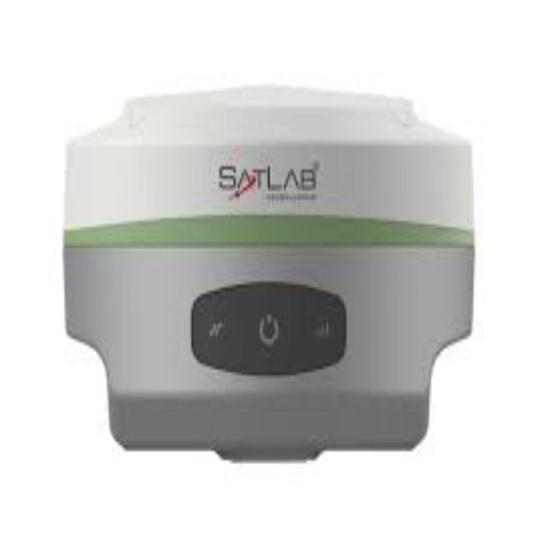
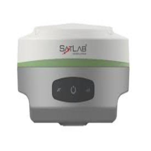
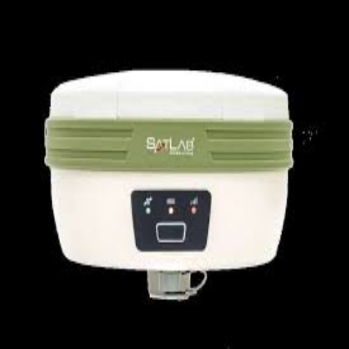
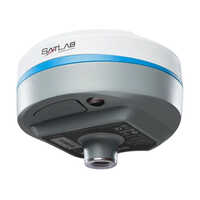
Satlab DGPS

1000000.0 INR/Piece

Minimum Order Quantity : 1 Pieces
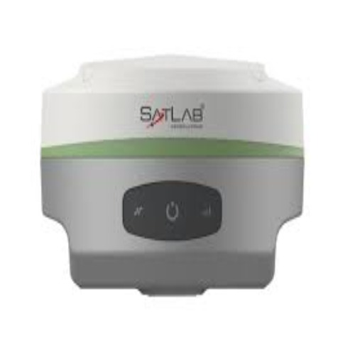
Satlab DGPS Price & Specifications

Weight Approx. 1.2 kg (estimated)

Usage & Applications Mapping, Surveying, Hydrography, UAV Base

Usage Mapping, Land Survey, Topography, As-built, Hydrographic, UAV Base Station

Type Wireless

Network Wireless connectivity supported

Memory Size Internal data storage (8GB est.)

Interface Type Bluetooth, serial, USB (typical for DGPS)

GPS Sensitivity High sensitivity, precise positioning

GPS Accuracy Centimeter-level (RTK supported)

Function Geospatial Data Collection, Geospatial Data Collection

Frequency Multi-frequency GNSS

Features Shock resistant body to 2m pole drop, IP67 Dust and Water Protection

Display LED status indicators

Dimensions 185 mm (diameter) x 95 mm (height) (estimated)

Battery Backup Upto 13 hours

About Satlab DGPS Detail


Highlighted as the latest standard in geospatial excellence, the Satlab DGPS brings sterling precision with 800+ channels and robust accuracy for critical fieldwork. Its noteworthy rugged body resists 2m drops, while IP67 protection ensures safe operation in harsh conditions, ranging from -40C to +65C. Equipped with integrated antenna, wireless connectivity, and versatile application modes, it stands as the finest choice for mapping, surveying, hydrographic, and UAV base tasks. With up to 13 hours' battery backup, discover your last chance to elevate geospatial data collection in India.

Where the Satlab DGPS Excels

The Satlab DGPS is highly suitable for professional use in challenging field environments. Its noteworthy accuracy and rugged build are ideal for land surveying, topographical assessment, as-built documentation, mapping, hydrographic tasks, and as a UAV base station. Whether it's for real-time geospatial data collection or static measurements, the Satlab DGPS adapts seamlessly to both base and rover usage types, delivering reliable results across a spectrum of industry applications.


Satlab DGPS: Fast Delivery & Certified Assurance

We proudly offer rapid dispatching for Satlab DGPS purchases, with competitive rates for both samples and bulk orders. Our streamlined logistics ensure swift delivery times, minimizing downtime for your project timelines. Every device is supplied with up-to-date certifications, underlining our commitment to sterling quality and compliance. Reach out to learn about our sample policy and receive an official offer tailored to your geospatial needs.


Usage/Application Mapping, Land Survey, Topography and As-built, Hydrographic, UAV Base Station
Number Of Channels 800+
Type Wireless
Antenna Type Integrated
Operating Temperature -40 to +65C
Operating Time Upto 13 hours
Shock Shock resistant body to 2m (6.5ft) pole drop
Standard Battery 2
Dust Water Protection IP67
Brand Satlab
Network RTK Accuracy H: 8mm + 0.5ppm RMS / V: 15mm + 0.5ppm RMS
Communication Network Internal 4G mobile network, including TDD-LTE/FDD-LTE/ WCDMA/EDGE/GPRS/GSM modes
Internal Battery 5000 mAh Lithium Ion Rechargeable Battery
Interface USB, TNC antenna port, SIM card slot, DC power input (5-pin)
Operation System Linux
Power Consumption 4.2W
Real-time Kinematic Accuracy H: 8mm + 1ppm RMS / V: 15mm + 1ppm RMS
Initialization time 10s
High-precision Static Accuracy H: 2.5mm + 0.1ppm RMS / V: 3.5mm + 0.4ppm RMS
Static Data Format GNS And Rinex
Communication Bluetooth, Wi-Fi, NFC
Data Storage 8GB Internal Storage


FAQ's of Satlab DGPS:


Q: How accurate is the Satlab DGPS for land surveying and mapping applications?

A: The Satlab DGPS delivers centimeter-level accuracy using RTK technology, making it exceptionally precise for mapping, land survey, topographical, as-built, and hydrographic applications.

Q: What are the main benefits of using the Satlab DGPS in harsh environments?

A: The device's rugged body, IP67 dust and water resistance, and shock resistance up to a 2m drop ensure reliable performance and durability in even the most challenging field conditions.

Q: When can users expect dispatching and delivery after ordering the Satlab DGPS?

A: Orders are processed efficiently for fast dispatching, with delivery timelines communicated at the time of offer to ensure minimal project delays.

Q: Where can Satlab DGPS be applied for geospatial data collection?

A: Satlab DGPS is suitable for a wide scope of applications, including land surveying, mapping, hydrographic measurements, topographical work, as-built documentation, and serving as a UAV base station.

Q: What process ensures reliable data storage and connectivity on the Satlab DGPS?

A: The device is equipped with 8GB of internal storage, multiple wireless connectivity options (Bluetooth, Wi-Fi, NFC), and supports formats such as GNS and Rinex for versatile, secure data handling.

Q: How does the Satlab DGPS perform in terms of battery backup and continuous operation?

A: With up to 13 hours of battery life and two rechargeable batteries included, the Satlab DGPS is engineered for uninterrupted fieldwork throughout long operational days.

product
product
product

More Similar Satlab DGPS Products

SatLab SL7 GNSS Receiver

SatLab SL7 GNSS Receiver

Minimum Order Quantity : 1 Units

Delivery Time : 30 Days

Weight : 750 Grams (g)

Usage : Industrial

Type : GPS Receiver

GPS Accuracy : High

Battery Backup : Long Life Days
SatLabFreyja GNSS Receiver

SatLabFreyja GNSS Receiver

Minimum Order Quantity : 1 Units

Delivery Time : 30 Days

Weight : 800 Grams (g)

Usage : Industrial

Type : SatLab Freyja GNSS Receiver

GPS Accuracy : High

Battery Backup : Long Life Days
SatLab SL900 GNSS Receiver

SatLab SL900 GNSS Receiver

Minimum Order Quantity : 1 Units

Delivery Time : 30 Days

Usage & Applications : Land surveying, mapping

GPS Accuracy : High

Function : GNSS Receiver, Other

Features : Multi-GNSS support, wireless operation

Display : LED Status Panel
SatlabSL700 GNSS Receiver

SatlabSL700 GNSS Receiver

Minimum Order Quantity : 1 Units

Delivery Time : 30 Days

Weight : 800 Grams (g)

Usage : Industrial

Type : Satlab SL700 GNSS Receiver

GPS Accuracy : High

Display : Digital